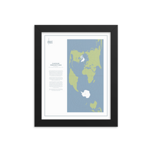
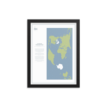
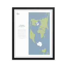
César François Cassini de Thury was the third of the four generations of Cassini who featured in the Map Men episode about the mapping of France. Thankfully, when he wasn't marching around France measuring the distances between various chateaus and copses, he produced this world map projection.
With the two poles sitting in the centre of two hemispherical squares, it looks at first glance like satisfyingly neat and comprehensible unpacking of the globe. On second glance, the resulting distortions look rather horrific.
It's a transverse aspect of an equirectangular projection, meaning that a meridian (in this case the Prime Meridian, running through London), has become the equator of the rectangle. Areas and angles along this meridian are preserved, as are distances on laterals perpendicular to this meridian. Everything else, unfortunately, is a mess, with distortion most obviously occurring in a north/south direction.
But it's always good to see the world differently, even if Central America ends up as long as Africa, and Australia just looks drunk.
Make a statement in any room with this framed poster, printed on thick, durable, matte paper. The matte black frame that's made from wood from renewable forests adds an extra touch of class.
• Paper thickness: 10.3 mil
• Paper weight: 5.57 oz/y² (189 g/m²)
• Alder, semi-hardwood frame
• Black .75” thick frame
• Acrylite front protector
• Lightweight
• Hanging hardware included


